Topographical Survey & Layout

Detail of Road Net Work for Bankura District
Client : GHERZI EASTERN LIMITED 16, Mahanirban Road, Kolkata – 700 029
Job : Demography survey for proposed District Road Planning under Pradhan Mantri Gram Sadak Yojona (PMGSY) for Bankura District, West Bengal
including preparation of drawing and data processing software.

Topographical Survey Map of Main Yard of GRSE
Client : GIFFORD Consulting Engineers Carlton House
Ringwood Road, Woodlands, Southampton, S040 7HT, United Kingdom
Job : Topographical Survey work of Main Plant Yard, River Bank approach to Main Yard, Survey and Measurements of all structures i.e. Dry Dock – 1, Hull Shop No. – I & II, Pipe Shop, Machine Shop etc. inside the Main Plant Yard.

Topographical Survey Map of Ganga Sagar Mela Area
Client : PUBLIC HEALTH ENGINEERING DTE.
Alipore Division 45, Ganesh Chandra Avenue, Kolkata – 700 013
Job : Topographical survey work including contour mapping and showing of mela layout at Ganga Sagar Mela Area of 2.00 Sq. Kilometer in South 24 Parganas, under Kakdwip Sub-Division, Public Health Engineering Dte.

Topographical Survey Map of Digha
Dist : Purba Medinipur, West Bengal.
Client : DIGHA SANKARPUR DEVELOPMENT AUTHORITY
(A Statutory Authority Of The Govt. Of West Bengal)
P.O. – Gigha, Dist. – Purba Medinipur, Pin Code – 721428
Job : Conducting detail Topographical Survey including Contouring of all landed property of “Digha, Sankarpur & Mandarmoni” by Total Station by triangulation close traverse, covering detail of physical features like rivers, nallha, lake, pond, sea, well, forest, roads, culverts, transmission lines, telephone lines, water pipe lines, electric poles, cross drainage works, tree, buildings, boundary wall etc. and recording spot levels etc. at a grid of 30m x 30m or as specified along with identification of unutilized land of DSDA, identification of other important buildings and structures, bus stands, railway lines/station, plotting and developing topographical contour map with 0.30m contour intervals in different layers and/or in combined layers as desired showing true North including connecting the nearest GTS bench mark, key plan, plot wise detail mouza information including record of right etc. including providing Geographical Co-ordinates of each Grid Point including all equipments, instruments personnel etc. and all other related charges required to complete the work in all respect as per drawings, specifications and directions of Engineer In-Charge including submitting six nos. hard copy and soft copy in different scales, as desired at Digha in the District of Purba Medinipur, West Bengal.

Water Pipe Line Route
Survey Map of Kharagpur Municipality
Client : OFFICE OF THE KHARAGPUR MUNICIPALTY
P.O. – Kharagpur, Dist. – Paschim Medinipur, Pin Code – 721301
Job : Proposed water pipe line route survey including contour survey issuing for proposed water pipe line route under UIDSSMT scheme.
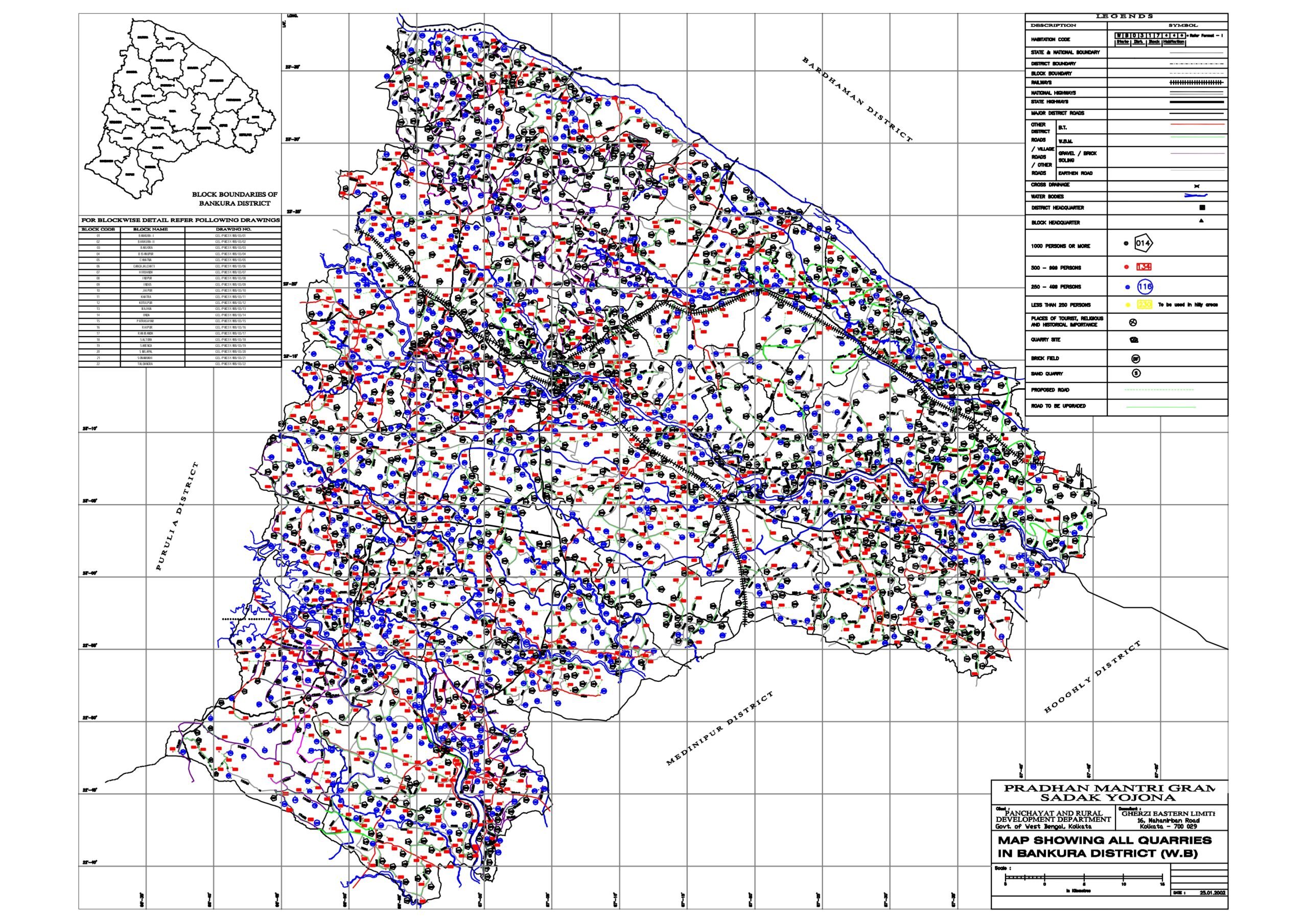
Detail of Road Net Work for Bankura District
Client : GHERZI EASTERN LIMITED 16, Mahanirban Road, Kolkata – 700029 Job : Demography survey for proposed District Road Planning under Pradhan Mantri Gram Sadak Yojona (PMGSY) for Bankura District, West Bengal including preparation of drawing and data processing software.
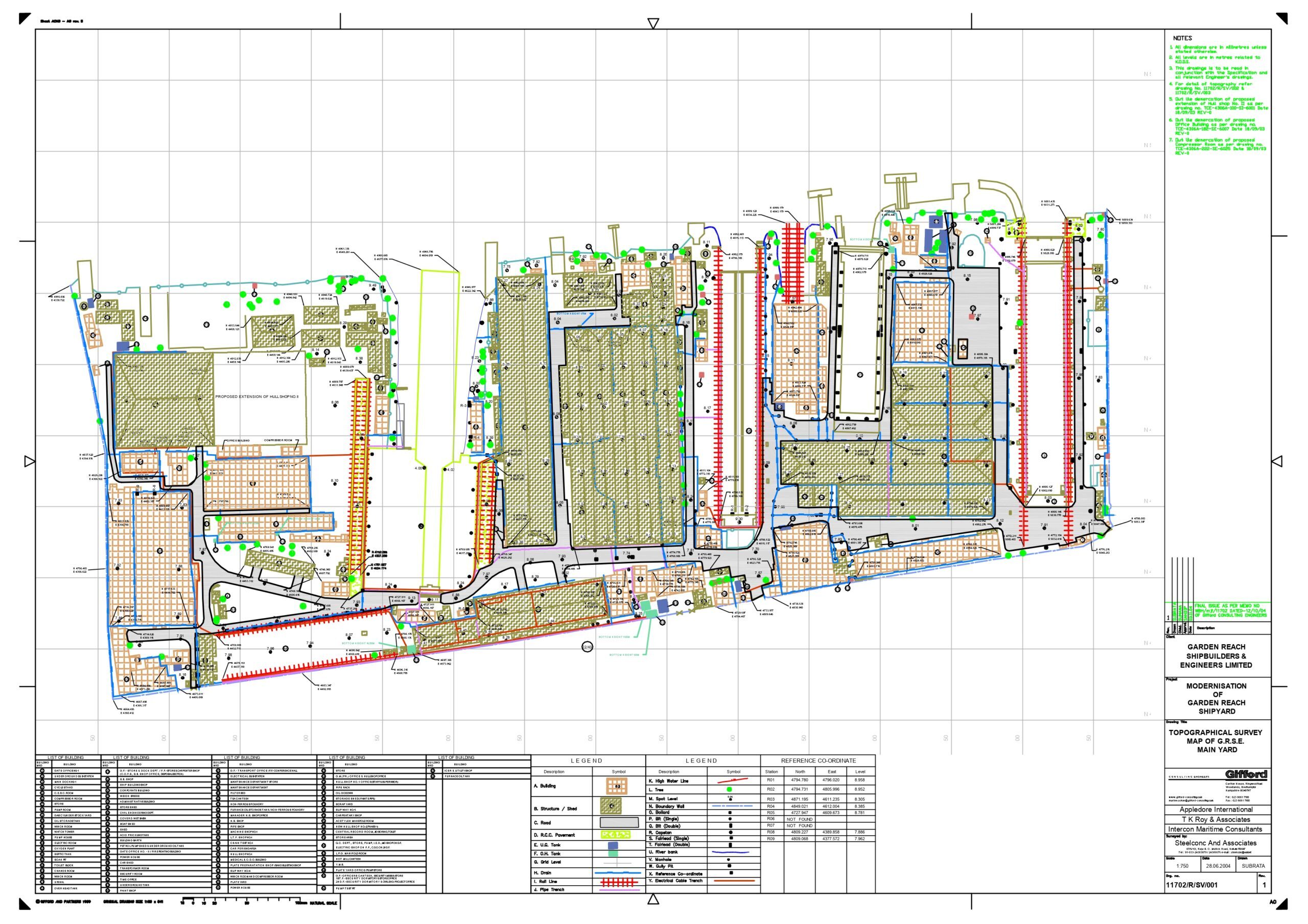
Topographical Survey Map of Main Yard of GRSE
Client : GIFFORD Consulting Engineers Carlton House, Ringwood Road, Woodlands, Southampton, S040 7HT, United Kingdom
Job : Topographical Survey work of Main Plant Yard, River Bank approach to Main Yard, Survey and Measurements of all structures i.e. Dry Dock – 1, Hull Shop No. – I & II, Pipe Shop, Machine Shop etc. inside the Main Plant Yard.
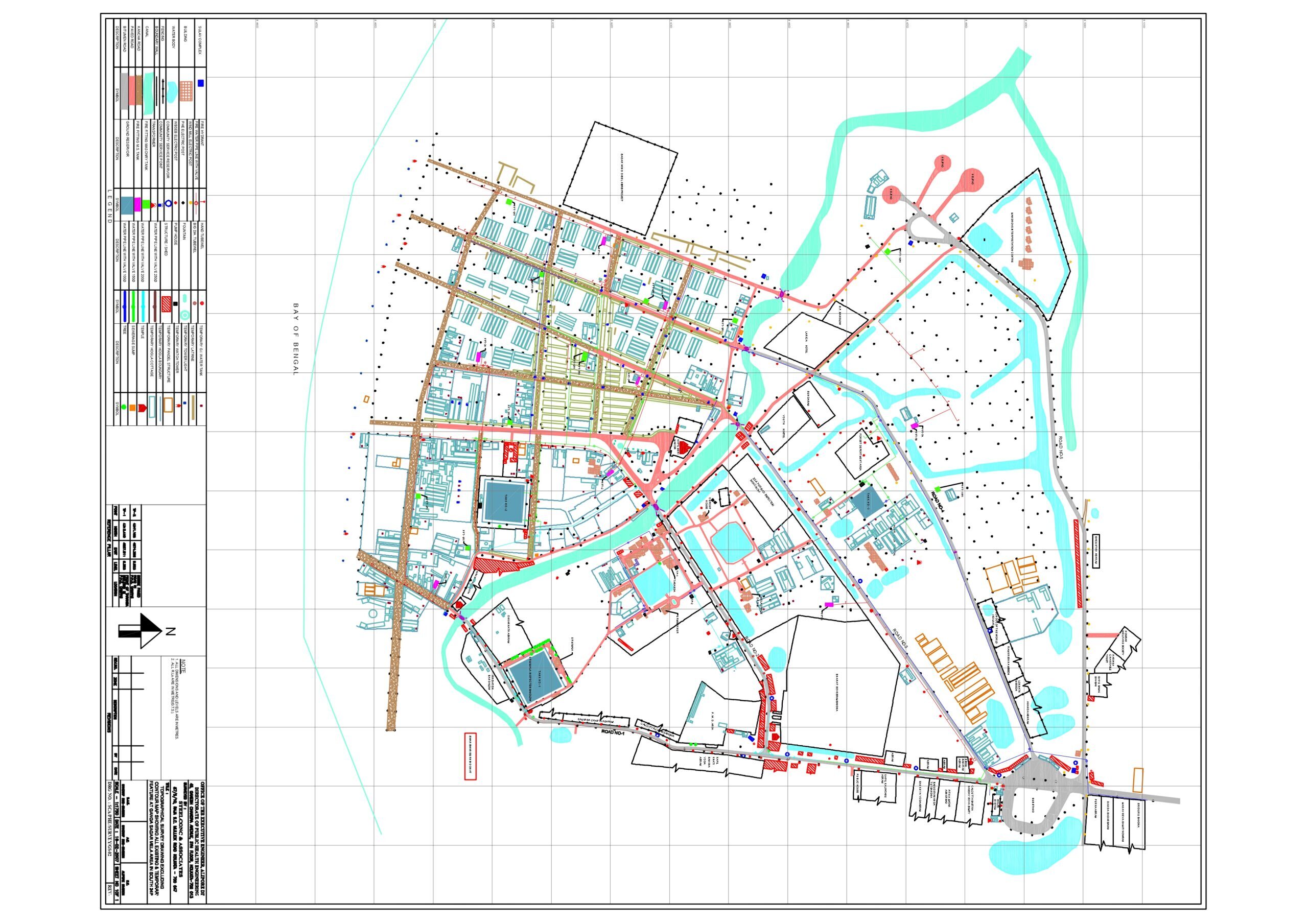
Topographical Survey Map of Ganga Sagar Mela Area
Client : PUBLIC HEALTH ENGINEERING DTE.
Alipore Division 45, Ganesh Chandra Avenue, Kolkata – 700013Job : Topographical survey work including contour mapping and showing of mela layout at Ganga Sagar Mela Area of 2.00 Sq. Kilometer in South 24 Parganas, under Kakdwip Sub-Division, Public Health Engineering Dte.
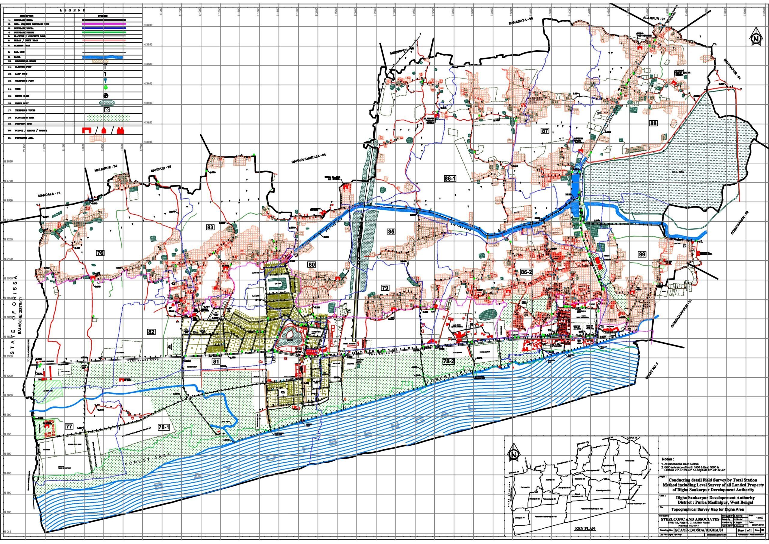
Topographical Survey Map of Digha, Dist : Purba Medinipur, West Bengal.
Client : DIGHA SANKARPUR DEVELOPMENT AUTHORITY (A Statutory Authority Of The Govt. Of West Bengal)
P.O. – Gigha, Dist. – Purba Medinipur, Pin Code – 721428
Job : Conducting a detailed topographical survey, including contouring at 30m x 30m grid (or as specified), for all land under “Digha, Sankarpur & Mandarmoni” using Total Station and triangulation methods. The survey will cover natural and man-made features (e.g., rivers, ponds, roads, buildings, trees, utilities), identify unutilized DSDA land and important structures, and connect with GTS benchmarks. A topographic map with 0.30m contour intervals will be developed, including mouza details and GPS coordinates of grid points. Final output to include six hard and soft copies as per specifications and instructions of the Engineer-in-Charge.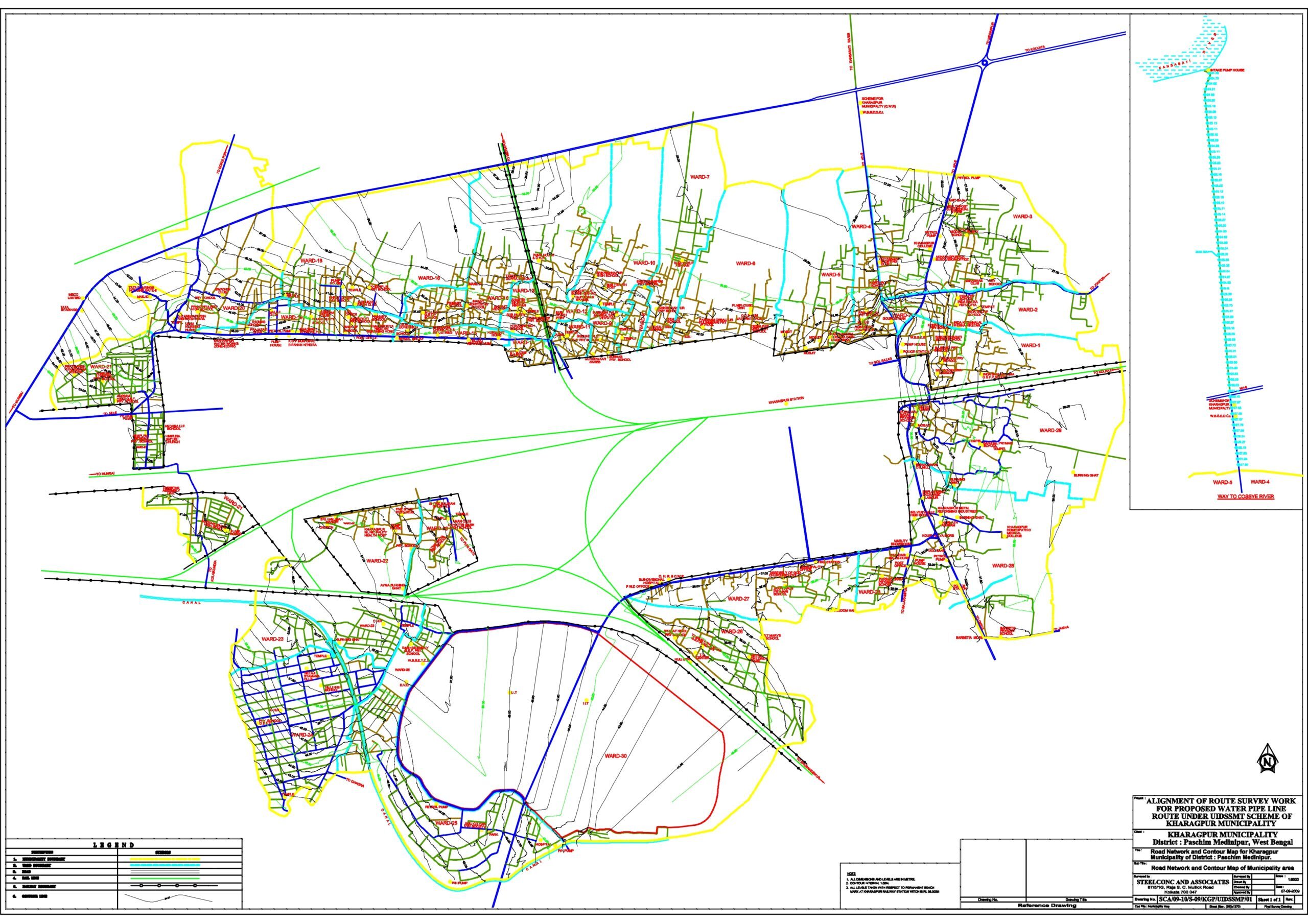
Water Pipe Line Route
Survey Map of Kharagpur Municipality
Client : OFFICE OF THE KHARAGPUR MUNICIPALTY
P.O. – Kharagpur, Dist. – Paschim Medinipur, Pin Code – 721301Job : Proposed water pipe line route survey including contour survey issuing for proposed water pipe line route under UIDSSMT scheme.
